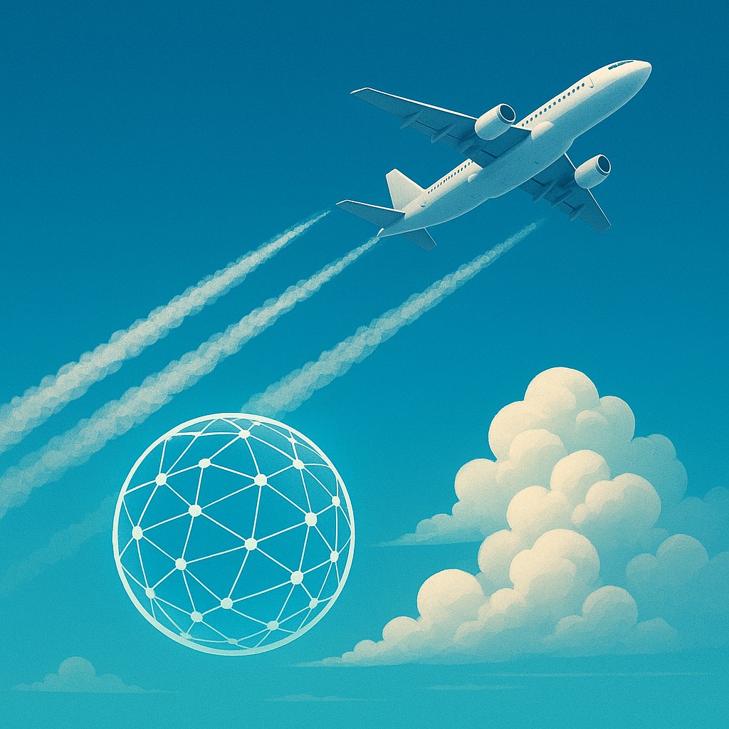
Look up at a clear blue sky on a busy afternoon and you will likely see thin, white ribbons stretching across the horizon. Most of us grew up calling these "vapor trails" or "streak lines," viewing them as a harmless byproduct of modern travel - perhaps even a poetic reminder of how connected our world has become. In reality, these are condensation trails, or contrails, and they are far more than just decorations in the atmosphere. They are human-made clouds that act like a thin, lace-like thermal blanket draped over the planet, trapping heat that would otherwise escape into space at night.
While we spend a lot of time discussing the carbon dioxide emitted by jet engines, it turns out that these fluffy white lines might be responsible for a huge portion of aviation's total climate impact. Because contrails form at high altitudes where the air is freezing, they can last for hours, spreading out into wide cirrus clouds that warm the Earth. However, there is a glimmer of incredible news. Recent trials and breakthroughs in satellite technology suggest that we can solve a significant chunk of this problem. We don’t need to redesign engines or invent a new fuel; we can simply nudge a plane a few thousand feet up or down to avoid the specific patches of air where these clouds tend to grow.
The Surprising Physics of Accidental Cloud Making
To understand how to stop contrails, we first have to understand why they exist. A jet engine doesn't just produce thrust; it also breathes out hot, moist air mixed with tiny particles of soot. When this exhaust hits the freezing, thin air of the upper atmosphere, the water vapor quickly turns into liquid and freezes onto the soot particles, creating billions of tiny ice crystals. If the air around the plane is dry, these crystals evaporate almost instantly and no visible trail forms. However, if the plane flies through a region of the atmosphere that is "ice-supersaturated" - meaning it is humid enough for ice to stay frozen - those crystals hang around.
These long-lasting contrails are the real troublemakers. once they stabilize, they catch heat radiating away from the Earth and reflect it back down, much like a greenhouse. The fascinating part is that these humid "sweet spots" for contrail formation are often very thin, sometimes only a few hundred or a thousand feet deep. This means that one pilot could be flying through a zone that produces contrails, while another pilot just 2,000 feet higher or lower is flying through perfectly dry air, leaving no trace behind. It is a game of vertical hide-and-seek with the atmosphere, where the goal is to find the dry lanes in a sky full of invisible moisture.
Historically, the challenge has been that pilots had no way of seeing these invisible layers of humidity. Weather balloons provide some data, but they are too far apart to give a real-time, high-resolution map of the sky. This is where high-altitude physics meets modern computing. By combining sophisticated weather models with real-time satellite imagery, scientists are now building "contrail forecasts" that show airlines exactly where these problematic patches of air are located. Instead of flying blindly through the humidity, pilots can now receive navigation tweaks to keep the sky clear.
Watching the Skies with Neural Networks and Satellites
If you wanted to track every contrail on Earth manually, you would need an army of observers staring at satellite feeds 24 hours a day. Fortunately, we have artificial intelligence for that. Recent trials, including high-profile partnerships between tech giants like Google and airlines like American Airlines, have used deep learning models to analyze thousands of satellite images. These AI systems are trained to tell the difference between natural cirrus clouds and the distinct, straight lines of aircraft contrails. This allows researchers to verify if a flight that was told to change altitude actually succeeded in avoiding a contrail.
The satellite data usually comes from geostationary satellites like GOES-16, which sit high above the Earth and provide a constant stream of infrared data. Because contrails have a specific temperature signature, the AI can "see" them even at night when regular cameras would be useless. This feedback loop is essential. It is one thing to predict where a contrail might form, but it is another thing entirely to prove that changing the route worked. By matching flight paths with satellite detections, scientists have confirmed that when planes are moved out of "contrail-prone" zones, these heat-trapping clouds appear much less often.
| Aspect of Mitigation |
Traditional Flight Strategy |
Contrail Avoidance Strategy |
| Primary Goal |
Minimize fuel and time |
Balance fuel use with climate impact |
| Data Source |
Standard wind and weather charts |
AI-driven humidity and satellite maps |
| Altitude Logic |
Stay at the most fuel-efficient level |
Adjust altitude by 1,000-3,000 feet if needed |
| Climate Impact |
Contrails trap heat for hours |
Contrail formation is actively prevented |
| Required Tech |
Standard GPS and Radar |
Real-time AI prediction and satellite verification |
The Delicate Dance of Fuel vs. Warming
One might wonder why we don't just change the altitude of every flight by default. The answer lies in the strict physics of aerodynamics. Airplanes are designed to fly at specific "optimal" altitudes where air density and engine performance strike a perfect balance, leading to the lowest possible fuel burn. When a plane climbs or descends to avoid a contrail, it often moves out of that "sweet spot." This means the engines have to work slightly harder, burning a small amount of extra fuel. This creates a classic environmental trade-off: is it worth burning 2% more fuel to eliminate a contrail that might have ten times the warming impact of that extra carbon dioxide?
According to recent studies and controlled trials, the answer is a resounding yes, but only if we are precise about it. Most flights (around 85% to 90%) don't actually form long-lasting contrails at all. The goal isn't to change every flight path, but to identify the "super-emitter" flights - the roughly 10% of journeys responsible for the vast majority of contrail warming. By focusing only on these specific flights, the total fuel penalty across an entire airline's fleet could be as low as 0.3%, while the reduction in total climate impact could be massive. It is arguably the most cost-effective way to make aviation greener in the short term.
This strategy requires close coordination between pilots, dispatchers, and air traffic controllers. Airspace is already crowded, and shifting planes up and down at random would cause chaos. Therefore, these avoidance maneuvers must be built into the flight planning software before the plane even leaves the ground. If a flight from London to New York is predicted to hit a large humid patch over the Atlantic, the dispatcher can file a plan that uses a slightly lower cruising altitude for that specific segment, keeping the journey safe, efficient, and cloud-free.
Correcting Common Myths About the Trails Above Us
As with any topic involving "things coming out of planes," there is a fair share of misinformation. It is important to clarify that contrails are not "chemtrails," which is a popular but baseless conspiracy theory. Contrails are simply frozen water, much like the "steam" you see coming out of your mouth on a cold winter morning. They contain no secret chemicals or biological agents; they are just a byproduct of fuel burning and physics. The reason they look different today than they did forty years ago is simply that there are more planes in the sky. Modern engines are also more efficient, which actually makes the exhaust cooler and more likely to form ice crystals.
Another misconception is that all contrails are bad. During the day, some contrails can actually reflect a small amount of incoming sunlight back into space, which has a cooling effect. However, the warming effect they have by trapping heat (especially at night) far outweighs this daytime cooling. This is why some researchers suggest that contrail avoidance is even more critical for evening and nighttime flights. If a plane flies during the day and creates a contrail, the impact is mixed; if it flies at 2:00 AM and creates a persistent cloud, it is strictly contributing to a warmer planet.
Finally, some people believe that we must wait for electric planes or hydrogen fuel to solve aviation's climate problem. While those technologies are vital for long-term sustainability, they are still decades away from powering long-distance flights across the ocean. Contrail avoidance is a "now" solution. We have the satellites, we have the AI, and we have the planes. By adjusting our navigation slightly, we can achieve substantial climate gains while the world works on the much harder task of reinventing engine technology. It is one of the few environmental problems where a software update can do as much good as a hardware overhaul.
Scaling Solutions from Trials to Global Standards
The success of recent pilot programs has sparked a lot of excitement, but moving from a "trial" to a "global standard" is a massive logistical project. Currently, the trials involve a limited number of flights with dedicated teams of scientists watching every move. To scale this up, we need to automate the entire process within the global air traffic management system. This means that "Contrail Impact" needs to become a standard metric in flight planning, right next to "Wind Speed" and "Estimated Time of Arrival."
There are also regulatory hurdles to clear. If an airline voluntarily burns more fuel to avoid a contrail, they are currently penalized by having to pay for those extra carbon emissions, even though they have done something good for the climate overall. International aviation bodies are now looking at ways to give airlines credit for contrail prevention. If we can measure how much warming was avoided, we can create financial incentives that make "clean flying" the most profitable choice for every company. This would turn the sky into a transparent marketplace for climate-positive navigation.
Beyond the technology and the math, there is something deeply inspiring about this approach. It represents a shift in how we view our relationship with the atmosphere. Instead of just "using" the sky as a vacuum to move through, we are learning to read its subtle textures and moisture levels. We are becoming more sophisticated observers of the natural world, using our most advanced tools to ensure that our footprint - or rather, our "air-print" - is as light as possible. It is a reminder that sometimes the most powerful solutions aren't about doing more, but about moving with more intention.
The Future of the Clear Blue Sky
As we look to the future, the goal is a sky where every flight path is optimized for the lowest possible impact on our heat balance. We are entering an era where data is just as important as fuel, and where a slightly different "routing decision" can be as effective as planting a forest of new trees. This is a story of human ingenuity at its best: taking a complex, global-scale problem and finding a solution hidden in the very clouds we accidentally created. By leaning into the power of AI and the precision of satellite observation, we are proving that we don't have to stop exploring the world to help save it.
The next time you are sitting in a window seat, looking out at the vast expanse of the upper atmosphere, remember that the altitude shown on your screen is part of a grander calculation. We are moving toward a world where the only thing we leave behind when we travel is the memory of the journey itself. The ribbons of white in the sky may never disappear entirely, but as we get better at navigating the "invisible lanes" of humidity, we can ensure that our desire to connect with one another doesn't come at the cost of the planet's future. It is a journey of a thousand miles, and it starts with a move of a few thousand feet.