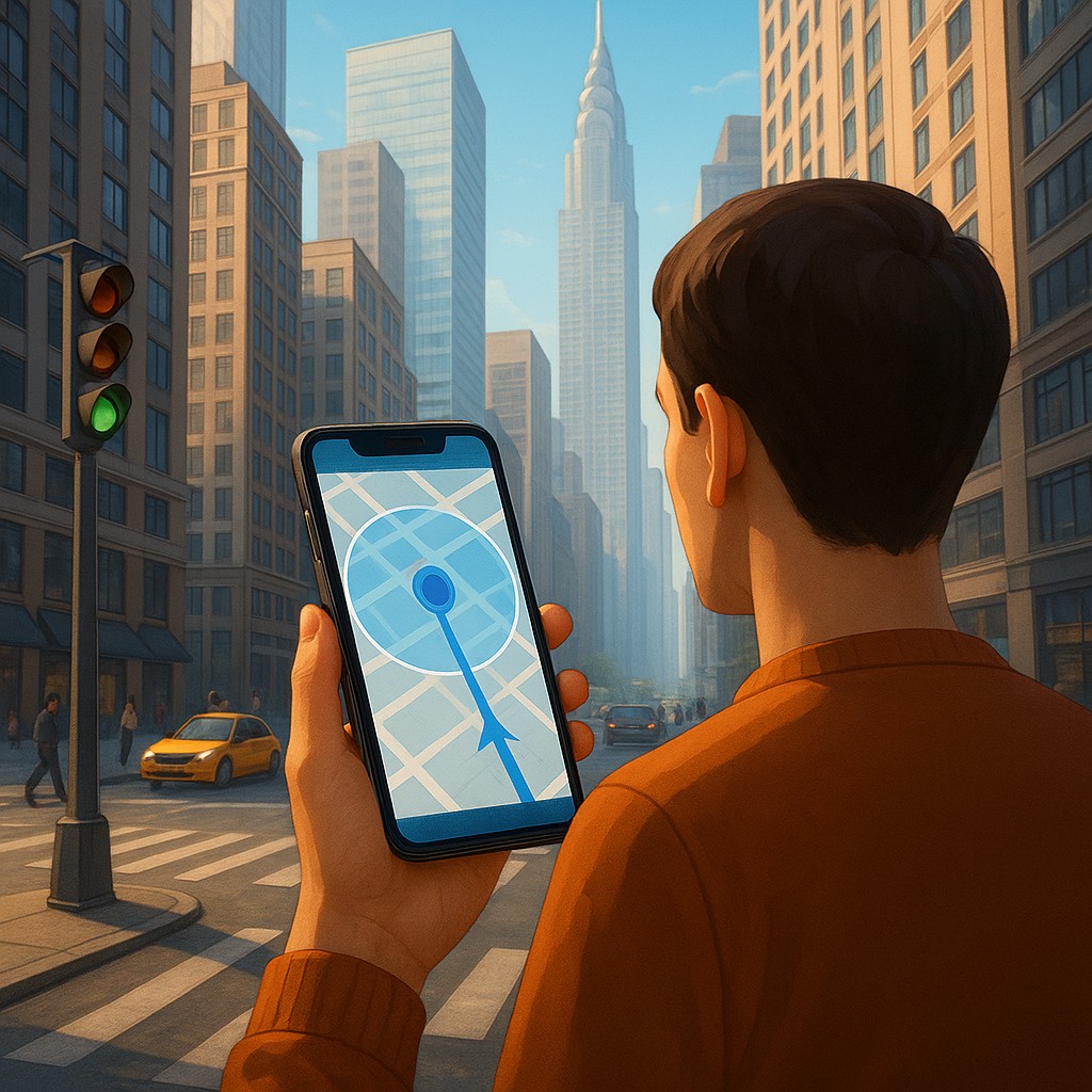
Imagine you are standing at a busy intersection in the heart of Manhattan or downtown Tokyo. You open your favorite navigation app, desperate to find the entrance to a small coffee shop tucked away in a side alley. You look at the screen, but the little blue dot representing your location is having a minor existential crisis. It flickers from one side of the street to the other, spinning in circles as if it cannot decide which way you are facing. One second you are apparently inside a skyscraper, and the next you are three blocks away in the middle of a river. This digital confusion is not just a glitch in your phone; it is a fundamental limitation of a technology developed decades ago for wide-open battlefields, not modern concrete jungles.
The problem is that our cities have outgrown the satellites orbiting above them. Global Positioning System (GPS) technology relies on a clear line of sight to at least four satellites to pinpoint your position through triangulation. When you are surrounded by glass, steel, and concrete, those delicate radio signals do not travel in a straight line. They bounce off the side of the Shard in London or the Burj Khalifa in Dubai, taking a slightly longer path to reach your phone. This delay, known as a multipath error, tricks your phone into thinking you are further away than you actually are. To fix this, engineers have turned to a solution that feels like it belongs in a science fiction movie: they are teaching your phone to see.
The Architecture of the Urban Canyon Problem
To understand why your phone struggles, we have to look at the geometry of the "urban canyon." When a satellite high in orbit sends a signal, it travels at the speed of light. Your phone records exactly when that signal arrives and calculates the distance based on the travel time. In an open field, this is incredibly accurate. However, in a city, a building often blocks the direct signal. Instead, your phone receives a "ghost" signal that has reflected off a nearby window. Because the reflected signal took a detour, it arrived a few nanoseconds late. In the world of GPS, a delay of just a few nanoseconds can result in an error of fifty or a hundred meters.
This phenomenon is the primary reason your blue dot jumps around. It is trying to make sense of conflicting data from multiple satellites, where some provide direct paths and others provide reflected ones. The phone’s processor tries its best to filter out the noise using internal sensors like the accelerometer and gyroscope, but these are "dead reckoning" tools. They are great at sensing that you moved five feet forward, but they have no idea where "forward" actually is on a global map. For years, this was just an accepted frustration of city life, but the rise of augmented reality and hyper-precise delivery services means "close enough" is no longer good enough.
Trading Satellites for Sight
Vision-Based Positioning (VBS) or Visual Positioning Systems (VPS) solve the urban canyon problem by ignoring the sky and looking at the street. Instead of relying on a faint radio beep from space, your phone uses its camera to recognize the world around it. The concept is remarkably similar to how humans navigate. When you walk out of a subway station, you do not check an internal compass; you look for a big green sign, a uniquely shaped clock tower, or a specific pattern of windows on the building across the street. You compare what you see with your mental map of the city to orient yourself.
A VPS does this on a massive, digital scale. Companies like Google and Niantic have spent years collecting billions of panoramic images using street-level mapping vehicles. These images are processed into a massive 3D point cloud, which is a digital skeleton of the world made of billions of distinct visual features. When you hold your phone up to "calibrate" your location, the app takes a frame from your camera and identifies "interest points," such as the corners of buildings, the shape of a doorway, or the specific lettering on a permanent storefront. It then compares this local "visual fingerprint" against the global database to find a match.
How Your Phone Processes the Visual Barcode
The magic happens in the way the software treats every building as a unique identifier. Think of the skyline as a giant, 360-degree barcode. For a computer, the specific spacing of windows on a 19th-century brownstone is as unique as a thumbprint. The system does not just see a "building"; it sees a collection of geometric shapes and high-contrast edges. By calculating the perspective of these shapes, the software can determine your latitude and longitude, your altitude, and even the exact angle at which you are holding your phone. This is known as "6-degree-of-freedom" (6DoF) positioning.
This level of precision is measured in centimeters rather than meters. While GPS tells the app you are "somewhere on 5th Avenue," VPS tells the app you are "standing exactly 1.2 meters from the lamp post, facing North-Northwest at a 15-degree upward tilt." This allows for features like "Live View" navigation, where giant digital arrows are layered directly onto the real world through your screen, pointing exactly at the door you need to enter. It eliminates the "first block" problem, that awkward moment where you walk in the wrong direction for thirty seconds just to see which way the blue dot moves.
A Comparison of Navigation Technologies
To better understand where Vision-Based Positioning fits into our technological toolkit, it helps to compare it directly with the systems we have used previously. Each has its own strengths and specific points of failure.
| Feature |
Standard GPS |
Inertial Sensors (Dead Reckoning) |
Vision-Based Positioning (VPS) |
| Primary Source |
Satellites (GNSS) |
Accelerometers & Gyroscopes |
Camera & 3D Imagery Database |
| Best Environment |
Open fields, rural roads |
Short tunnels, movement gaps |
Dense urban centers, urban canyons |
| Accuracy Range |
5 to 20 meters |
Loses accuracy quickly over time |
0.1 to 0.5 meters |
| Main Weakness |
Signal bounce (multipath) |
Accumulates drift errors |
Low light, snow, privacy concerns |
| Processing Power |
Moderate |
Very Low |
High |
The Neural Cost of High-Definition Location
While VPS feels like magic, it comes with a high "computational tax." Unlike GPS, which is a passive receiver that requires very little power, VPS is an active, resource-heavy process. Your phone's processor must run complex computer vision algorithms in real-time, identifying thousands of points in every frame, while simultaneously using your data connection to talk to a massive cloud database. This is why your phone might get warm or your battery might drain faster when using augmented reality walking directions. The device is essentially performing high-level geometry and pattern matching thirty times every second.
Furthermore, these systems are only as good as the data used to train them. This creates a fascinating challenge for engineers: the world is not static. Trees grow and lose their leaves, shops change their signs, and scaffolding goes up for construction. If a VPS was built using images from a sunny summer day, it might struggle to recognize the same street in a blizzard or at 2:00 AM. Modern systems are becoming more reliable by focusing on "permanent" features, like the structural lines of a building, rather than "temporary" ones, like a colorful billboard or a parked truck. However, the battle between the digital map and the changing physical world is constant.
Misconceptions About Visual Privacy
A common concern when users hear that an app is "scanning" their surroundings is whether their privacy is at risk. It is a natural fear to think the app is recording video of your surroundings and sending it to a corporate server. However, the mechanism behind vision-based positioning is actually quite abstract. In most modern versions, the actual image of the street never leaves your device. Instead, the phone converts the image into a "feature map," which is a series of mathematical coordinates representing edges and corners.
To the human eye, these feature maps look nothing like a photograph; they are more like a scattered plot of dots. The server receives these coordinates, matches them against the database, and sends back a location fix. This process, often called "edge computing" or "on-device processing," ensures that the app knows where you are without necessarily knowing who you are with or what you are doing. The goal is positioning, not surveillance. Engineers also have a strong incentive to keep the data packets small and anonymous to save on bandwidth and maintain user trust.
The Future of the Invisible Grid
As we move forward, vision-based positioning will become the foundation for technologies far beyond simple walking directions. In the near future, autonomous delivery robots will use these systems to navigate sidewalks with millimeter precision, avoiding fire hydrants and steering around pedestrians. Smart glasses, which many predict will eventually replace the smartphone, will rely entirely on VPS to anchor digital information to the physical world. This ensures that a virtual "open" sign hangs perfectly over a real-world cafe door regardless of how you move your head.
We are essentially building an invisible, digital grid over our physical reality. This grid turns every landmark, every brick, and every unique piece of street furniture into a waypoint. By bridging the gap between what a computer "knows" from a map and what a camera "sees" in the moment, we are solving one of the most stubborn frustrations of the digital age. The era of the "confused blue dot" is coming to an end, replaced by a world where our devices understand their place in the environment as clearly as we do.
The next time you find yourself lost among the skyscrapers of a major city, take a moment to appreciate the billions of calculations happening in the palm of your hand. Your phone is performing a feat of digital recognition that would have been impossible just a decade ago, turning the chaos of the urban landscape into a perfectly readable map. It is a reminder that even when the stars (or satellites) are hidden from view, we can always find our way by simply looking at what is right in front of us. Keep exploring, stay curious about the invisible systems supporting your journey, and never be afraid to let your phone "see" the way home.